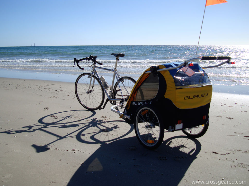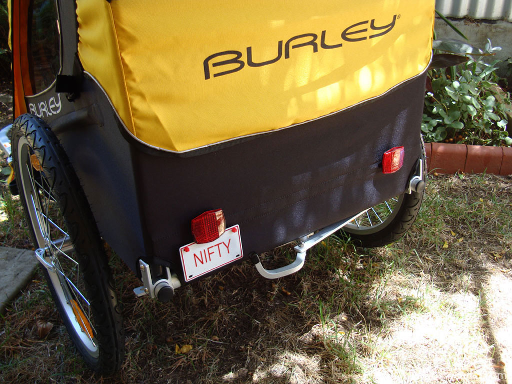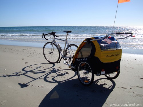
We recently added a Burley Encore to our armament of baby goods. What is it? Well, the Encore is a two-child bicycle trailer that falls somewhere in the middle of Burley’s range of child trailers. In case you’re wondering, they also have a line of bicycle trailers to tow your dog or cat, or take them skiing (I’m not kidding).
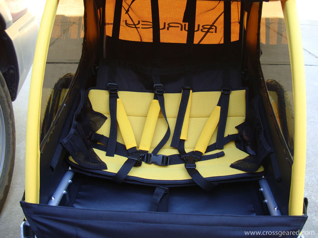
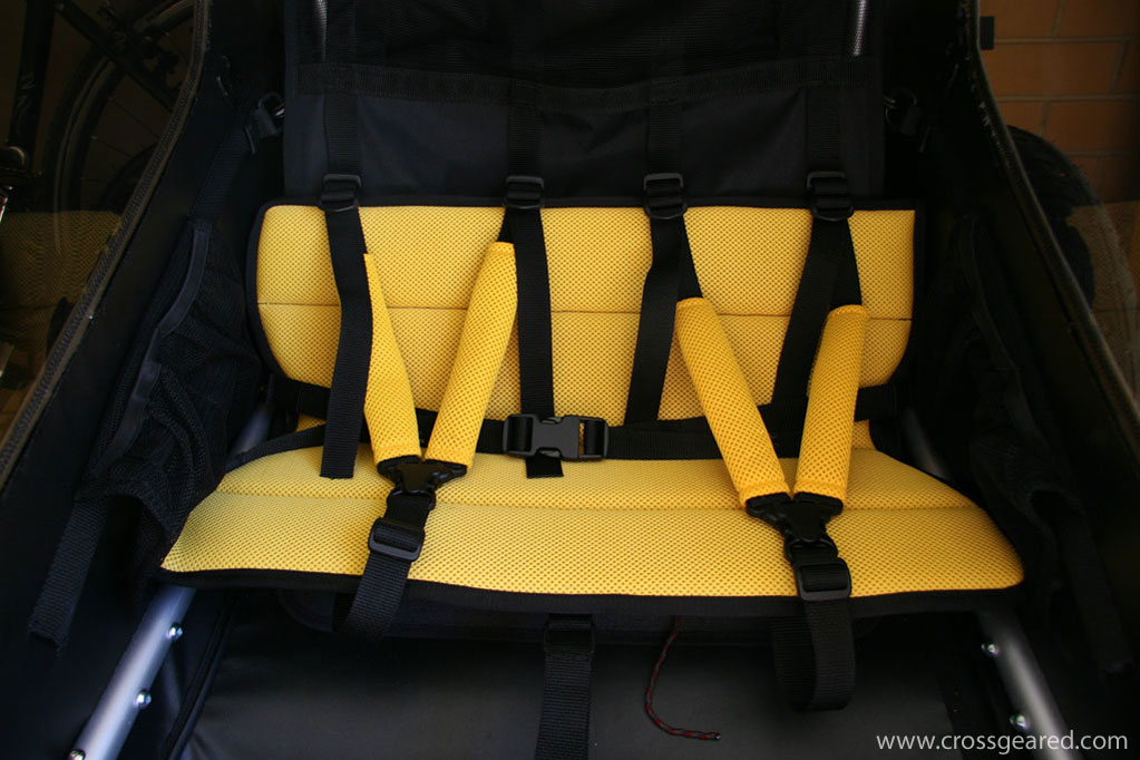
First impressions are that the trailer appears to be quite well made. The fabric and stitching looks very durable, the aluminum frame folds easily and locks securely in the ‘open’ position. The seat and belts look comfortable, although I wasn’t able to personally test them. Additionally, the tinted side windows and large front and rear mesh for ventilation are a nice feature for warm and sunny South Australian summer days. The Encore also includes a zip-down rain cover for the less warm and considerably wetter South Australian winters.
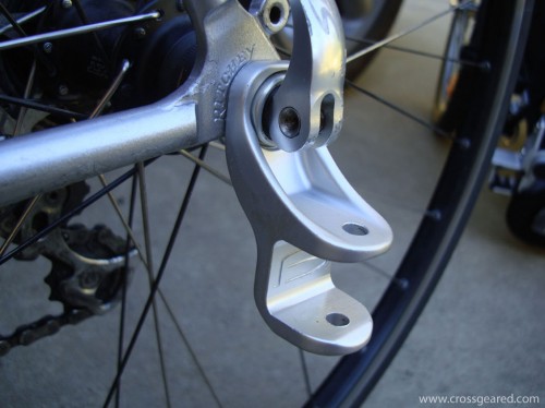
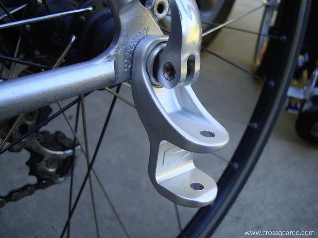
The Encore’s hitch is very well designed. Like other Burley trailers, the hitch mounts to the bike through the rear axle/skewer, and the trailer is attached to the bike with an easy to use pin. The design allows the bike to lean while keeping the trailer level, and stays well clear of the rear wheel. That last point is an important one for me. The first trailer I towed with the Gunnar was borrowed from a friend, and had a hitch that attached to the left chainstay. In addition to marring the paint, the hitch rotated into the rear wheel and bent eight spokes. The touch-up paint on the rear dropout is from the borrowed trailer.
The Encore pulls and tracks well. The wheels and bearings roll well, and the tires offer what appears to be a decent ride for ~10kg inflated to 25-30psi. The trailer width has not been an issue while riding in bike lanes, or on bike paths.
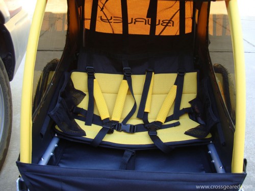
Even though the first few rides have gone well, I have had to make some changes. First, the seat was already sagging under a light load. Even without a load, it is clear that the seat is going to need some work. As you can probably see, the seat back and base are only supported at the outer edges. The result is that the middle of the seat back collapses into the ‘helmet pocket’.
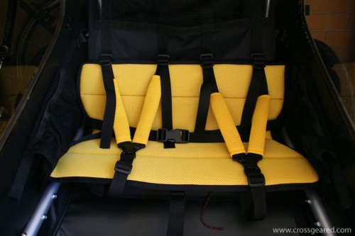
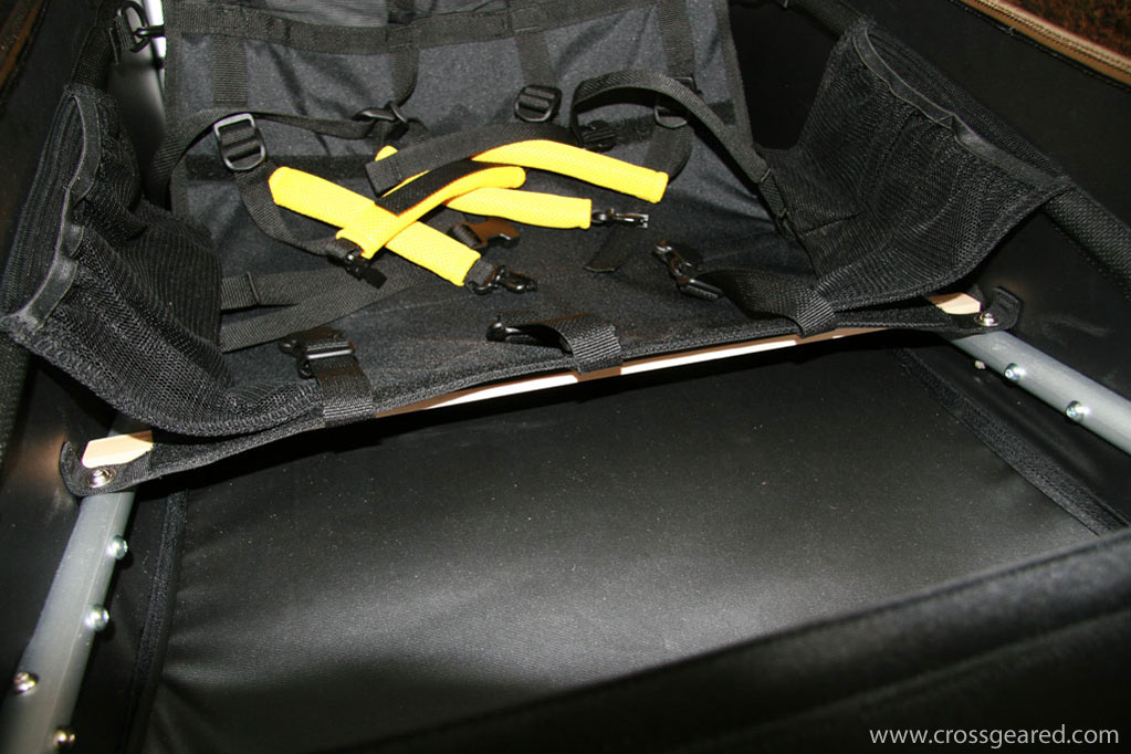
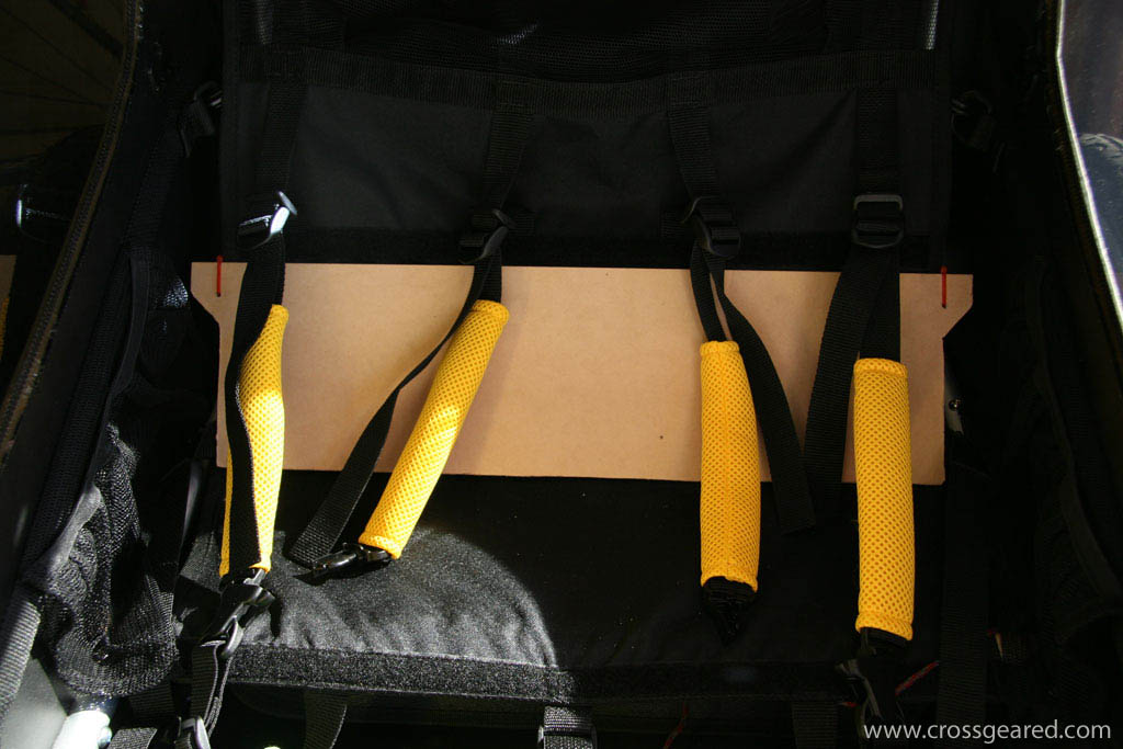
To fix the sagging seat, I added a wooden bow spanning the frame rails under the front edge of the seat base. I also added a bow to the top of the seat back, clamping around the nylon seat back and tied to a small piece of MDF cut to match the seat back contour. The seat base no longer sags. The seat back is now fully supported by the panel and outer straps, as a result, the ‘helmet pocket’ in the back of the seat actually works. I’ve also added a ~1/4″ thick stiff foam rubber mat between the seat base and cushion, although I may remove it as it is probably not necessary. Both wooden bows are under the foam seat cushion, and our passenger seem to like my changes. The seat back panel has the added advantage of keeping the cargo from poking passengers in the back.
None of the changes modified any existing part of the trailer, so I can revise my additions if necessary. Also, none of the modifications interfere with folding the trailer, so they do not have to be removed for storage.
Here are some detail photos of the seat modifications:
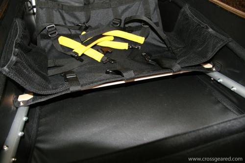
The front bow test fit
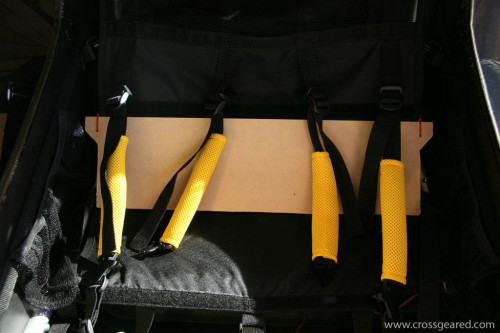
The seat back panel and bow (the bow is behind the nylon seat and top edge of the panel, not visible)
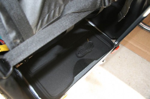
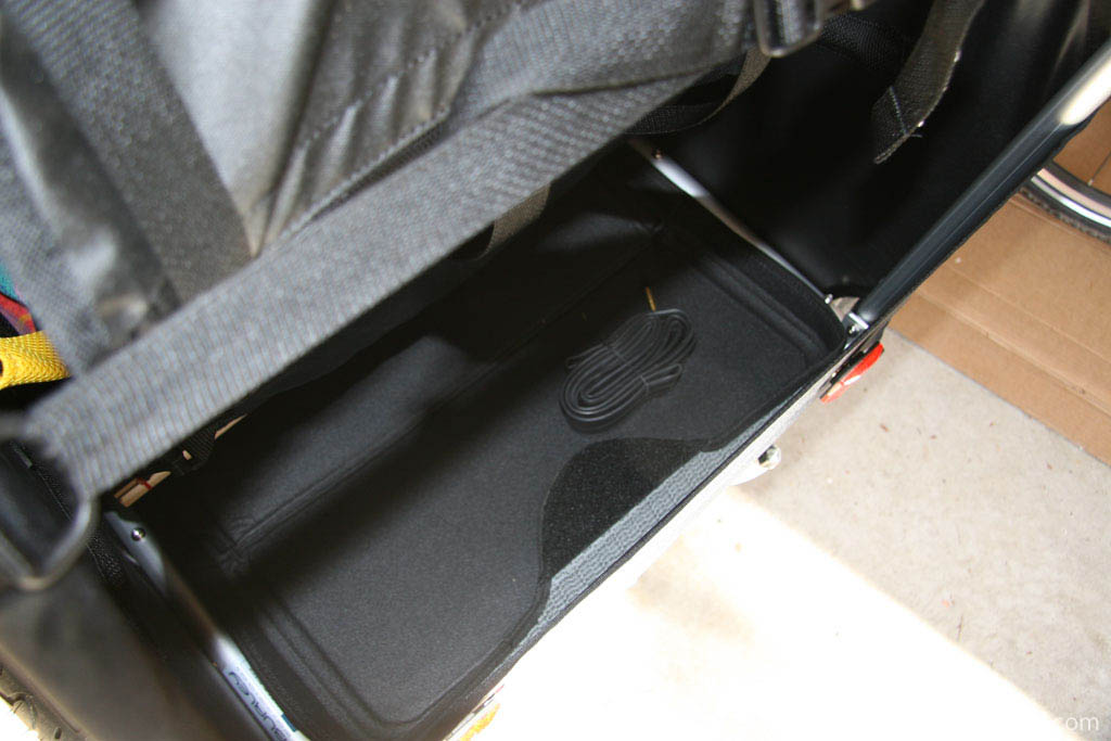
In addition to the seat modifications, I added a cargo mat. The rear cargo area of the trailer has a relatively thin nylon floor. I added this re-purposed car seat mat, which happen to fit perfectly. As you can see, it easily accommodates a spare tube.
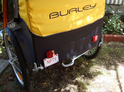
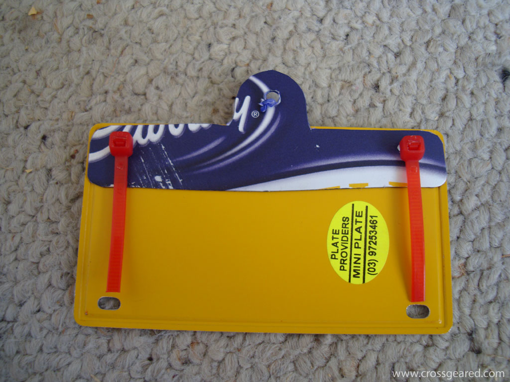
The final addition isn’t functional, but it is important. Don’t bother looking-up the plate, this is photoshopped (yet another new verb…), but still quite nifty in its original unaltered form.
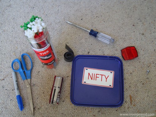
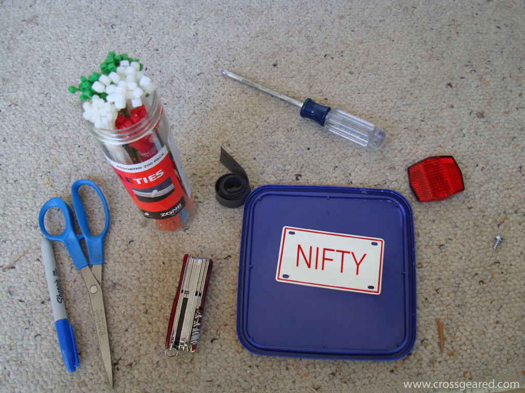
To make your own plate bracket, start with a plate, a plastic ice cream container lid, and some zip ties.
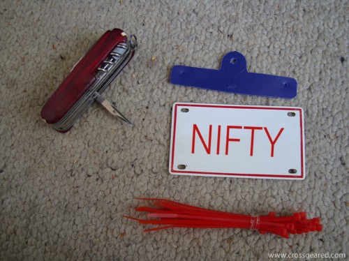
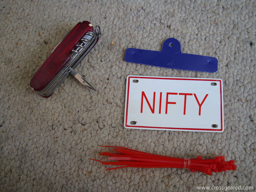
Cut a bracket from the lid, and attach the plate to the bracket with the zip ties.
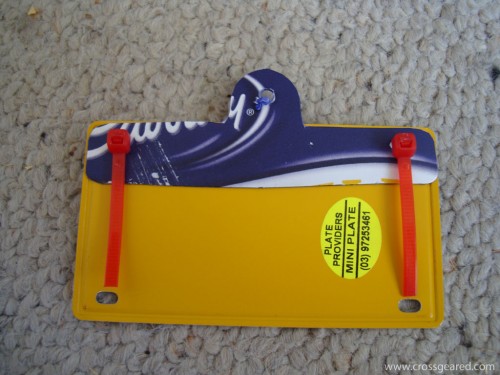
I left some of the excess zip tie on the back to keep the metal plate from contacting the back of the trailer.